

The threat of severe weather has increased across Greene County this afternoon and evening, and the National Weather Service has now issued a Severe Thunderstorm Warning for the southwestern part of the county until 3:45 PM.
At 2:50 PM, radar indicated a severe thunderstorm near Newport moving southeast at 20 mph. The storm is capable of producing 60 mph wind gusts and nickel-size hail.
The warning includes the Greene County communities of Caney Branch and Cedar Creek, along with Newport, Parrottsville, Bybee, Del Rio, Round Mountain, and Max Patch.
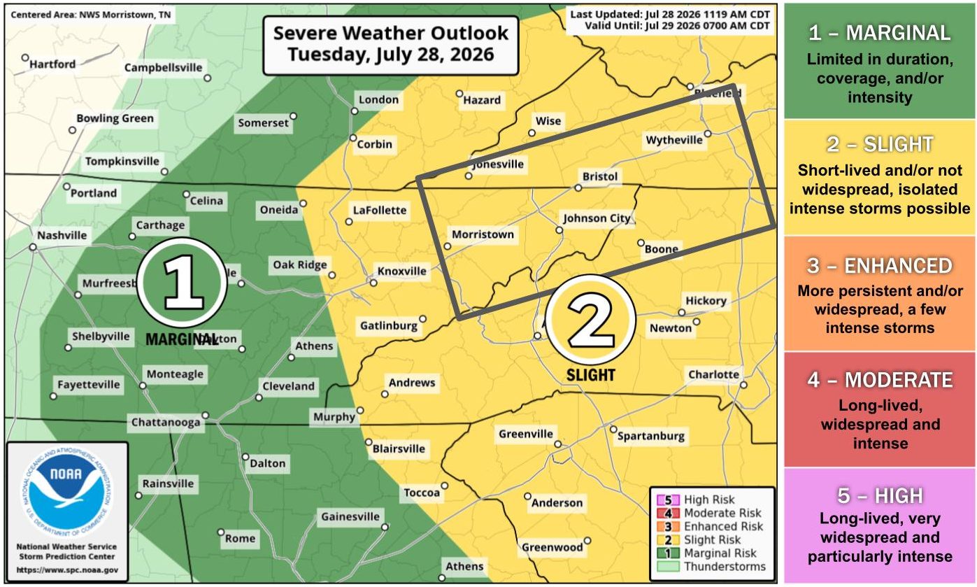
Forecasters say conditions have become more favorable for strong to severe thunderstorms to develop across northeast Tennessee, including Greene County. The combination of weather boundaries left behind by this morning’s storms and favorable conditions in the atmosphere is expected to produce another round of thunderstorms through this evening.
The primary threats are damaging wind gusts up to 60 mph and hail up to one inch in diameter. However, the National Weather Service says the potential for an isolated tornado or two has increased, particularly across northeast Tennessee, including Greene County.
Heavy rainfall is also possible, and localized flooding could develop where storms repeatedly move over the same locations.
A Severe Thunderstorm Watch remains in effect until 8:00 PM EDT, and storms are expected to move out of the area between 8:00 and 9:00 PM.
In addition to the severe weather threat, hot and humid conditions continue this afternoon, with heat index values between 100 and 105 degrees across portions of the Tennessee Valley.
Greene County EMA Communications Coordinator Letisha Ricker urged residents to make preparations before storms arrive and to ensure they have multiple ways to receive weather warnings and emergency alerts.
Sign up for WGRV News Text Alerts by texting the word NEWS to 423-340-5050. And stay tuned to 99.5 FM WGRV.com, 103.1 FM WIKQ, and 95.5 FM WSMG.
Looking ahead, much more comfortable weather is expected Wednesday through Friday, with lower humidity and temperatures slightly below normal. Rain and thunderstorm chances are expected to increase again over the weekend and continue into early next week.