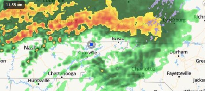
The National Weather Service is stating that potential exists for significant flooding through the weekend, and has issued a Flood Watch for our area until Noon Sunday.
Multiple rounds of rainfall are expected through tonight, with heavy rainfall rates possible in thunderstorms tonight. Additional rainfall in excess of 2 inches is expected in and near the watch area through Sunday morning. Stream and river flooding, flooded roads, as well as mud and rock slides are all possible.
We are also under a Wind advisory until Noon AM Sunday as strong winds are also expected across the East Tennessee mountains through the weekend. Southwest winds 15 to 30 miles per hour with gusts up to 45 expected. Mountain wave high winds are likely across the Tennessee mountains and adjacent foothills, where wind gusts up to 70 mph are possible. This could cause downed trees and power outages due to saturated grounds.