

Prescribed burns in the Cherokee National Forest are causing smoky conditions across East Tennessee this morning.
The prescribed burns are being conducted in Washington County in areas near the Nolichuckey River going into Erwin, and just across the mountain near the Sampson Mountain Wilderness.
The fires will be highly visible and are less than one mile from I-26 south of Johnson City. Access to some roads will be restricted during the burn time.
- Wildland firefighters expect to burn the following areas:
ATV (968 acres) – Washington County – Lies between Buffalo Mountain OHV trail, Briar Creek Road (NFSR 188), and Ramsey Creek Road (NFSR 4355). Buffalo Mountain OHV trail will be closed day of burn. - Deacons Creek (1,600 acres) – Washington County – Along Deacons Creek and Tellico Branch Road (NFSR 53711). North of Highway 81, south of Dry Creek Road, northwest of the Nolichucky River.
Prescribed fires are used on the Cherokee National Forest to improve wildlife habitat, thin forest fuels, and help manage for desirable vegetation. Prescribed fires target specific areas that need the natural process of fire to improve forest health and reduce wildfire intensity.
Firefighters proceed with a prescribed fire only when the conditions outlined in the prescription are met. Due to changing weather conditions, it’s difficult to identify the specific days the burns will proceed.
For additional information please contact the Unaka Ranger District at (423) 638-4109.
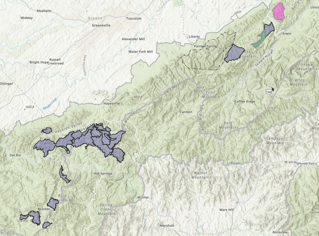
CLICK HERE for an interactive map of possible prescribed burn areas.
Other areas that are in the prescribed burn plan between now and May 31 include:
Unaka Ranger District (423-638-4109) Carter, Cocke, Greene, Unicoi, and Washington Counties
- Big Pine (1,950 acres) – Unicoi County – South of Clarks Creek Road just east of Sampson Mtn Wilderness, approximately 5 miles southwest of Erwin, TN.
- Ramsey Creek (620 acres) – Washington County – Off Briar Creek Road (NFSR 188) and Ramsey Creek Road (NFSR 4355).
- Pinnacle Mountain (780 acres) – Washington County – Between Briar Creek Road (NFSR 188) and Ramsey Creek Road (NFSR 4355). *Buffalo Mtn OHV trail will be closed day of burn.
- ATV (968) – Washington County – Lies between Buffalo Mtn OHV trail, Briar Creek Road (NFSR 188), and Ramsey Creek Road (NFSR 4355). *Buffalo Mtn OHV trail will be closed day of burn.
- Stone (850 acres) – Unicoi County – North of Hwy 107, along Irishman Branch Road (NFSR 313). *May be burned jointly with Irishman Branch Burn.
Deacons Creek (1,600 acres) – Washington County – Along Deacons Creek and Tellico Branch Road (NFSR 53711). North of Hwy 81, south of Dry Creek Road, northwest of the Nolichucky River. - Canlot (47 acres) – Unicoi County – Along Canlot Road (NFSR 189A) and North of Spivey Mountain Road (Hwy 19W).
- NorCal B (815 acres) – Washington County – Just southwest of the Nolichucky River, along Rich Mountain Road (NFSR 190).
- Chestnut Ridge (1230 acres) – Cocke County – Just northwest of Max Patch Mountain. Along NFSRs 22491, 3249, 22501, and 225101. Along the TN/NC border.
- Fed Fork (512 acres) – Cocke County – 3 miles south of the French Broad River and 2 miles south of Hwy 25/70. Along NFSR 96-1 in the Wolf Creek Drainage
Watauga Ranger District (423-735-1500) Johnson, Carter, and Sullivan Counties
- Gum Hollow (87 acres) – Carter County – South of intersection of Dry Creek Road (Hwy 361) and Gap Creek Road (Hwy 362) on NFSR 5311.
- Cook Hollow (500 acres) – Johnson County – On the Northwest side of Watauga Lake near Sink Mountain Boat Ramp Road.
- Harpers Creek (275 Acres) – Sullivan County – Along NFSR 4002 and just east of Wyatt Hollow Road.
- Cedar Gap (404 acres) – Carter County – 2 miles southeast of Hampton, TN. Just south of Dennis Cove Road and off NFSR 293A.
- Weaver’s Branch (424 acres) – Carter County – 7 miles northeast of Elizabethton. One mile south of NFSR 202 (Panhandle Road) and 1 mile north of Hwy 91. Along NFSRs 60682 and 60681.