

After a high of 73 today, the weather is expected to take a turn this afternoon. Rain should be moving in, and a high wind advisory remains in effect until 8 am on Sunday
In the mountainous areas, south winds will range from 25 to 40 mph with gusts up to 80 mph possible.
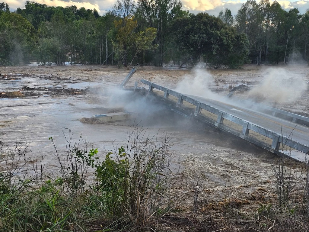
And the National Weather Service Office reports once high winds arrive, any ongoing wildfires could spread rapidly until, and if, widespread heavy rains arrive this evening. Due to the probability of rain, a Flood Watch has been issued for portions of East Tennessee.
A Red Flag Warning has been issued for Greene County until 11:00 PM tonight. A very high fire danger remains in effect for our area so Do Not Burn.