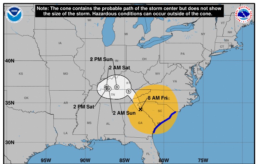

According to the National Weather Service, there is a high wind warning for all of East Tennessee and a flood watch is in effect for flash flooding across portions of East Tennessee. The Tennessee Valley and Southern Appalachians will feel the remnants of Hurricane Helene, with tropical downpours mainly this morning. As of this morning, the weather service predicts most of the rain may occur in the morning and evening hours.
Flash flooding is expected and there could be an additional 2-4 inches of rain in areas. The weather service stated in addition to the rain, strong winds are in the forecast. The highest winds are expected across the higher elevations of the east TN, southwest VA, southwest NC mountains, and Cumberland Plateau. The risk of damaging winds has increased across the region. Prepare and have a plan in place in case of an emergency. Prolonged outages are possible.
With soils incredibly saturated, trees are likely to fall during this period of high winds. Flood waters will be receding and may still pose a threat before streams retreat back within their banks.