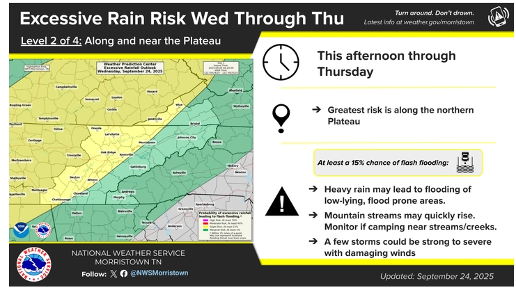
Strong winds are the greatest threat from scattered showers and thunderstorms that could move through the area later this afternoon, according to the National Weather Service.
The greatest risk is to the north and west of Knoxville, but all of East Tennessee could see the possibility of heavy rainfall that could lead to flooding of low-lying, flood prone areas.
The timing of the weather is mainly between 2:00 this afternoon and 9:00 this evening, with a slight chance of damaging winds in excess of 60 miles per hour.