

UPDATE: A Flood Watch will be in effect for Greene County from Wednesday morning through Thursday morning. A Flood Watch will also be in effect for the southeastern portion of the county from Wednesday morning through Friday afternoon.
According to the National Weather Service in Morristown, scattered showers and thunderstorms are possible again today, primarily after 12 PM. Strong to severe thunderstorms are expected this mid-afternoon, just after sunset, with wind gusts from 40 to 60 mph possible.
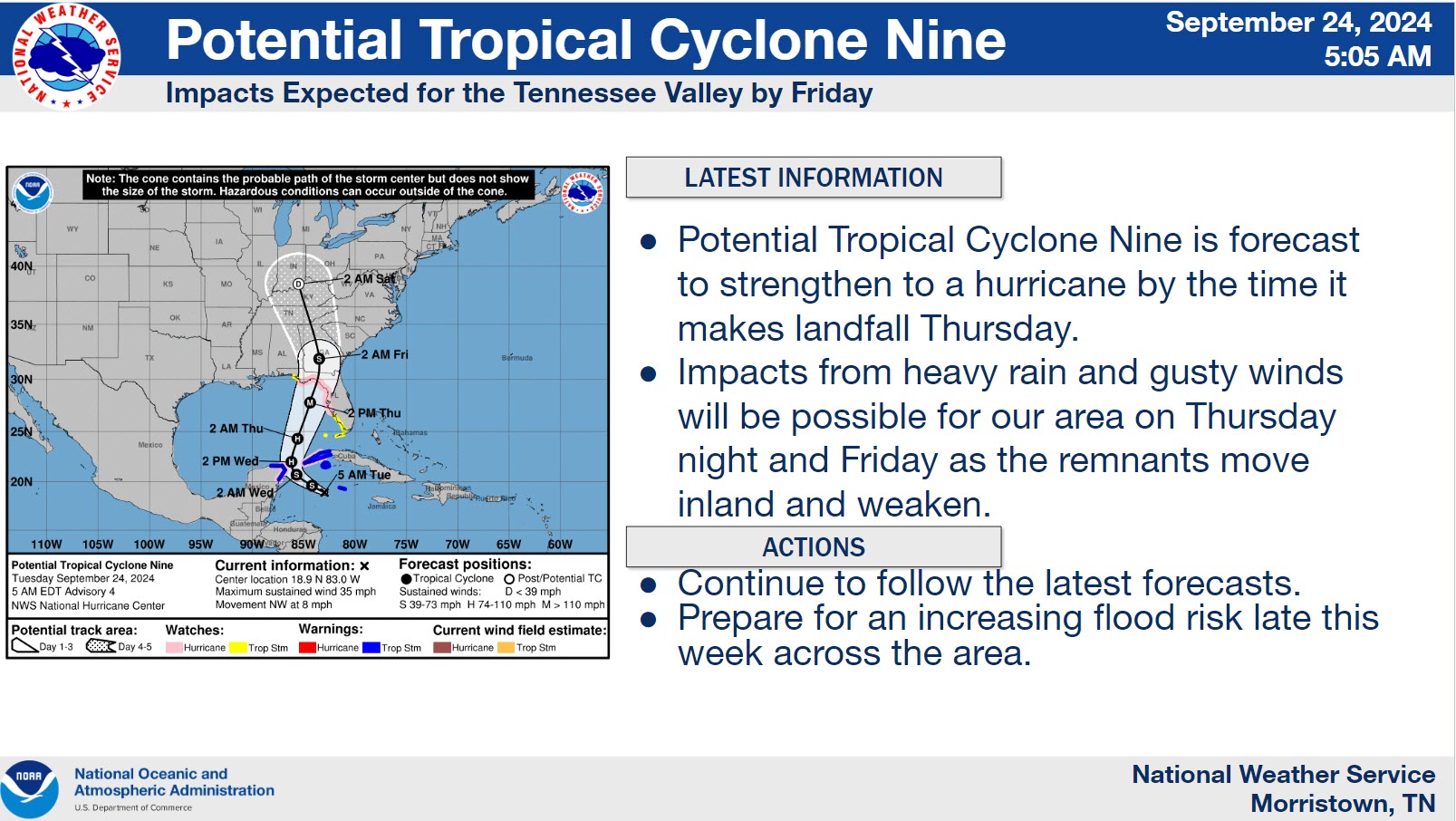
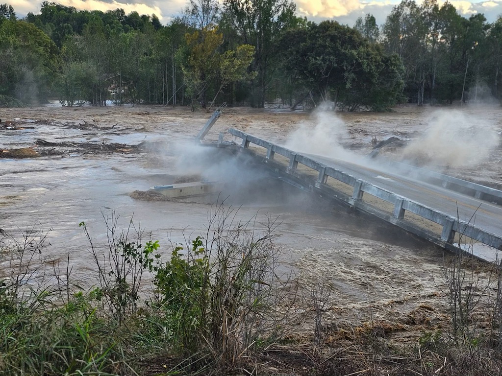
The National Weather Service says a tropical system may move into the Tennessee Valley late this week. Unsettled weather will persist Wednesday into Thursday bringing additional rainfall. Localized flooding may occur, especially in areas that see repeated rounds of heavy rain.
From late Thursday through Friday Night, a tropical system may move north into the Tennessee valley and southern Appalachians. The weather service is unsure of the exact impacts, timing, and path of this storm. However, torrential rainfall and localized flash flooding are possible.
Windy conditions during the tropical remnants will most likely continue, especially across the far east Tennessee Mountains, Plateau, and southeast Tennessee.
Information from the Greeneville/Greene County, TN Office of Emergency Management & Homeland Security:
- Scattered thunderstorms across the entire area: Marginal Risk (Level 1 of 5) for Greene County
- Damaging wind gusts up to 60 mph. Hail up to 1″ not expected, but cannot rule it out.
- Most likely time frame for a strong to low end severe storm is the mid afternoon to early evening hours (2 PM to 8 PM ).
- Be weather aware later today, especially if you have outdoor plans.